La Sal Mountains, Part 2
 |
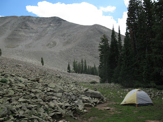
| Camp below Mellenthin |
 |
| Lexi enjoying happy hour in the LaSals |
As we watched the sun set and an almost full moon rise behind us, I thought of nocturnal visitors. We hadn't seen any major wildlife yet, but the night before at our Oowah Lake camp, signs warned about bears. Just that morning I thought I heard one struggling in the brush across from our campsite. Now, as we left the viewpoint to store our food in a tree away from camp, I thought about how our tent was right in the middle of the only clear path to water, that trickling spring that came out of the rocks.. I kept thinking of some creature coming through for a late night drink and stumbling into an REI Half Dome full of dinner. I know that black bear attacks are rare, but knowing how unnerved I can get by even a rare encounter makes me somewhat resistant to ever camp in grizzly territory.
There was little chance of rain Saturday night, although I expected it to be cold, so we slept with the rainfly on and the vestibules unzipped. As I lay in the tent, to my right was the ghostly bright grey stone of the talus slope, illuminated by a nearly full moon and to my left were the dark jagged shadows of the forest. Unlike our camp the night before, we had the full force of the bright moon shining into our tent, which I kind of liked. The silhouettes of lone trees up on the talus stood starkly in the pale bluish grey of the sky. Not a great night for stargazing, tonight was the moon's moment. I pulled Wallace Stegner's “Beyond the 100th Meridian” out of a ziploc bag and started reading about John Wesley Powell's landmark journey down the Colorado River. It's not unusual for my travels to these stunning western landscapes to inspire my interest in their histories. We were going to sleep early, before 10pm, but the Sunday in front of us would require as much rest as we could get. The day would include a summit attempt of Mt. Mellenthin, breaking camp, and then the long hike back to Oowah Lake.
At 6:30, the alarm on my watch went off from the mesh gear pouch hanging from the top of the tent. A restless night thinking about bears made for tough sleeping, but once sunrise hit, we were done with ursidae concerns and shifted to our concern to time. We wanted to complete our days tasks without having too late of a drive back to Salt Lake. I crawled out of the tent with more enthusiasm than normal and once I retrieved the bear bag, I started prepping a simple breakfast of bagels and polenta. Lexi got up soon after me and we gathered up a few items for my daypack and secured the rest of our camp against any rain that might come. I grabbed my three essential pocket items from the tent: a Fisher Space Pen, my Leatherman and a compass. Lexi joked that while camping, I always needs something with which to “fight, write, and know where I am”.
The skies looked good currently, but a mass of clouds built up in the west. I didn't have any immediate concern from the weather and I figured we still had time to get up and down before any possible storms. We started off around 8:15. We skirted the talus eon the thin strip of bare ground for no more than 5 minutes before we had to plant our feet on the uneven, noisy surface of granite that ascended up the length of Mt. Mellenthin. I led us on a rather straight forward route that took us towards a spine of the north ridge. After scrambling over some steep sections, we gained the ridge and I was disheartened to see a much easier approach on the opposite side; a gentle grade that cost a longer circumnavigation of the ridge. Regardless of our route however, steady footing was not a trait Mt. Mellenthin would grant us. The rocks jammed and contorted into each other; sometimes sticking out like blades. Once we reached the northern tip of the ridge at 11,775', the incline became a more manageable and we now had three directions with which to take in the view. From this point, Mt. Tukuhnikivatz was the start of a clockwise vista that included all but a slice of perspective blocked by Mellenthin. While I wasn't exhausted, the hour of hiking without any sort of mellow section with which to recover did take a toll, especially when we saw nothing but the same loose rock above us. We had been out about an hour and still were almost a 1,000' from the top.
Lexi's frustration was apparent, but only in the quiet way with which she struggled, not because of any vocal objections. This was already the highest point we had reached together and I told her I would have very little regret if we chose to turn back here. I told her this, already knowing it would take much more than this to make her give up. On many of our journeys, we have a superficial dynamic of gaging each others experience. I remind her not to push herself just to keep from disappointing me, continually asking her if she's enjoying things. For her part, she asks if her slower pace is souring my experience. By now though, beneath these sympathetic assurances, we've gained an underlying knowledge that together we'll still manage to make it to whatever goal we've set and look fondly on the experience in spite of the challenges.
 |
| Lexi's wardrobe malfunctions on the climb to Mellenthin |
The fatigue of balancing on rocks, scrambling on all fours and having every footstep punctuated by a concentrated pressure point of rock began to sap us, but Lexi marveled at the way I still “danced “ up the mountain. I still felt good and with the summit looking close, I did try to pick the pace up as we started out again. I tried to urge her on with estimates of how soon we would be on the top. Those estimates would have been pretty accurate except that when we reached the western extreme of the summit, we saw the true high point still lay to the east.
 |
| Looking west over the Colorado Plateau |
An incipient perspective superseded the glory of another mountain climbed. This mountain range opened a capacious point of view that I'm sure John Wesley Powell would have valued for not just it's stunning beauty but for clarifying the arrangement of such a cracked and fissured landscape. From deep in the canyons of red rock country, there is little in the way of horizon. The views, while stunning, are often confined to the closest canyon wall. Now, standing 7,000 feet over the Colorado Plateau, I began to pull together the enormous landscape that fascinated Powell. The Colorado River coming in from the east along the chasm of rock that created Professor Valley. The deep, anonymous fissure of the Green River, which descends from high above in the Wind River Mountains of Wyoming until uniting with the Colorado in the depths of an area known simply as “The Confluence”. Across the expanse of plateaus that make up Canyonlands National Park, diffused by sun streaking through storm clouds were the peaks of the Henry's Mountains and Thousand Lake Mountain, where I spent a cold fall night a few years ago gathering in the view from the opposite direction. Utah's sprawling wilderness, which exemplifies both the fantasy and reality of the west, could be consumed from this one point. It was the first time I ever stood on the mountain and felt that my geological perch paled in comparison to the earth below me. The efficacy of millennial erosion in the countless canyons below excited me. Were the LaSals here just to give nature geeks like me a great view of one of America's greatest treasures? The pile of rocks I now stood on inverted my view. Instead of seeing a lush, alpine texture continue for miles, I absorbed a spastic eruption of grey granite in a sea of sandstone. Two worlds collide here in the LaSals, and I think that's what I will most remember of this trip.


Comments